

Bubbling Up . . .
I spent the morning and early afternoon mostly working on website stuff, both the Knife website and the the Big Huntsville Storage website.
Around noon our power went off here at the park. It seems to happen every couple of weeks or so, and usually comes back on pretty quickly. And it was back on in just a couple of minutes . . . and then back off again. And then off again. And then back on.
This raised my suspicions so I got up to check the LED that monitors our shore power voltage and found it, not at the normal 122-124 volts, but showing 131 volts. And as I watched, every so often, it would bounce up to 132 and then back down to 130. But then it momentarily hit 133 and our Progressive EMS (Electrical Management System) disconnected us from shore power to protect the coach
I took my new 50 amp tester out to the pedestal to check things out.
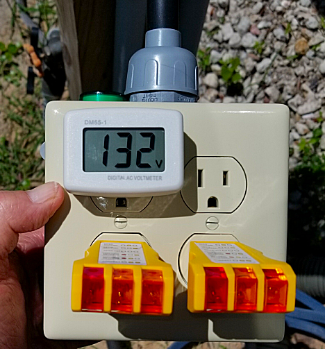
And I had 131-132 volts on both legs so it wasn’t an unbalanced voltage situation. I watched it for about 15 minutes without it ever going above 133 volts, so I switched the EMS into bypass mode so we’d get power back in the coach. I did keep monitoring the voltage in the coach, and about 15 minutes later it was back down to normal. So a little later I switched the EMS back into the circuit.
I don’t what the problem was, but it seems to have been a power company problem. I’ll keep an eye on it.
But I did get another plastic tub filled up which we took over to the storage room a little after 4pm. Then it was on up to Whataburger for dinner. #6’s for both of us. Plus I got an Apple & Cranberry Salad to bring home for dinner tomorrow night.
I received a number of nice emails from readers about my Bay of Fundy repost yesterday. I guess most of our readers today weren’t reading the blog back in 2009 since I had just started it in January, and it was mostly so family and friends could keep track of us.
So I thought I do a repost of our visit to the Bar Harbor, ME area.
Bar Harbor and Bubbles…
August 24, 2009
Today we made the 50 mile trip down to the Bar Harbor area to see some of Maine’s Atlantic coast. The drive was pretty uneventful, except for a 25 minute wait right outside of Ellsworth for road work. Luckily, by the time we came home they were finished for the day.
Right after we got into the Bar Harbor area, we stopped for lunch at a small seafood place called Gateway Diner and had lobster rolls and sweet potato fries, and then split a pumpkin crumb pie with ice cream. Great food, but unfortunately for me, the place also had a gift shop with a lot of moose stuff.
Mucho $$$$ later, we stopped at the Bar Harbor Visitor’s Center right down the street to check out a tip that the lady at the diner mentioned about a loop road through Acadia National Park.
Getting directions, we headed out around the loop.
The first place we stopped was a scenic viewpoint overlooking Frenchman Bay, and this was just the start of a lot of beautiful scenery.
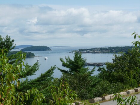
The dock area on the right side of the picture is Bar Harbor.
The next stop was Sand Beach.

Although the beach was closed today, apparently people really swim here, even though the water temp usually doesn’t get much out of the 50’s.
And some of the other views in the area are amazing.


Leaving the Sand Beach area, we drove down to a spot that unfortunately has been in the news lately.
The area is called Thunder Hole because of the noise of the waves when the right conditions makes the sounds reverberate and sound like thunder.
The area is also popular because you can go out on a rock that juts out into the Atlantic ocean and stand where the waves come in over your feet when the tide is right.
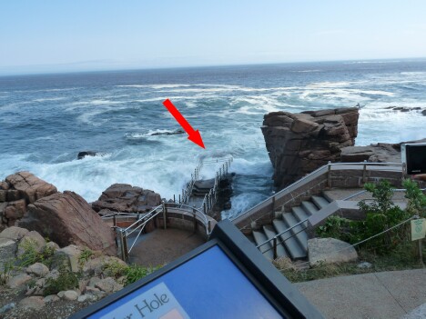
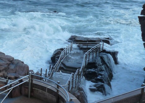
This point is where about 20 people were smashed by a 25 foot wave caused by a combination of high tide and Hurricane Bill. 11 people were hospitalized with broken bones, and 3 people, a 7 year old girl, her father, and an unrelated 12 year old girl, were swept out to sea in the 55 degree water.
The 12 year old girl and the father were pulled from the water by the Coast Guard, but his 7 year old daughter was later found dead.
When we were there, the area was still closed off, but a ranger said the waves have to get over the top of the handrail before it’s closed off.
Leaving the area, we drove further around the loop to more fantastic scenery.


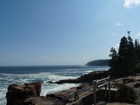


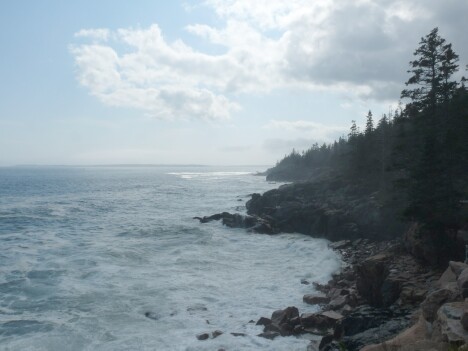
Toward the end of the 27 miles we passed the Jordan Pond Inn, a restaurant we had been told about and thought we would later have dinner there.
Leaving the loop, we headed over to Bar Harbor to look around. The first thing Jan found, wouldn’t you know it, was a couple of moose stuff gift shops.
She really wanted this one, but we couldn’t figure out how to get it in the rig.

So she settled for trying on the latest in moose wear.

Walking down the hill we were able to look out over Bar Harbor itself.

And of course the many flower beds everywhere.

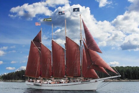
One of the ships I noticed in the harbor was a beautiful 4-masted schooner called the “Margaret Toddâ€.
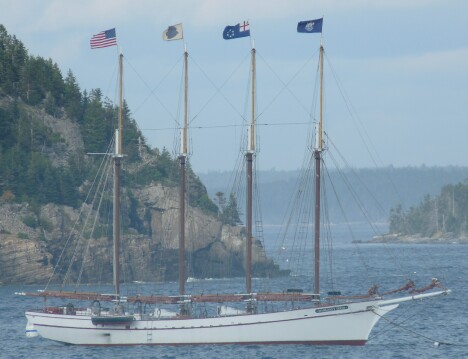
And rather than being an old ship, she’s only about 10 years. She was launched in 1998 and built to give Windjammer cruises to the tourists.
Here’s what she looks like under full sail.
Before heading back over to Jordan Pond Inn for dinner, we drove down to the end of Bridge St. to take a look.

When it’s low tide, a sandbar is revealed that extends over to Bar Island in the distance, allowing people to walk over to the island. Unfortunately, at high tide it just looks like a boat launch ramp.
Timing is everything!
Our dinner at Jordan Pond Inn was fantastic and we had a great meal. The restaurant was really something,

and the scenery was something else.
The view from the outside dining are is of an island called “The Bubblesâ€
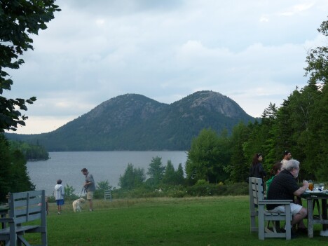
Of course, the locals call it by another ‘B’ word, but I’ll leave it as an exercise for the reader to figure out what the word is.
After a really great day, we finally headed home about 7 pm. Luckily, the morning’s road work was over, so we were home in about an hour.
Today is our last day here in Bangor. Tomorrow we head about 130 miles northeast to Houlton, ME, which is about 2 miles from the Canadian border.
We’ll stay there for three or four days, cleaning up some loose ends before we head over the border.
Thought for the Day:

agsdfg
Fundy-mentals . . .
Nothing really happened at work or at home today. Just the same old, same old.
So since Jan and I were talking the other day about our trip out to Newfoundland in 2009, I thought I’d repost one of the highlights of that trip, our visit to the Bay of Fundy with its 50 foot daily tides.
We entered Canada from Houlton, ME on August 28, 2009 and reentered the US on September 14, 2009. Then we headed north back into Canada, coming down through Quebec, Montreal, and Ottawa, before again reentering the US on September 20nd near Ogdensburg, NY. Then it was on to Niagara Falls.
Originally posted on September 13, 2009
Today is our last full day in Canada for a while, and is also our day to visit the Bay of Fundy area.
The Bay of Fundy is home to the highest tidal changes in the world. In a 6 hour period the water level can change 30-50 feet depending on the phase of the moon.
But first we decided to try a place we’d heard about here in Canada called Cora. Cora is a type of restaurant that seems very popular here in Canada. It is only open for breakfast and lunch. It closes at 3 pm every day.
And it was fantastic. The food is delicious, and every menu item is a work of art. Hopefully we’ll be able to eat here for breakfast tomorrow before we leave.

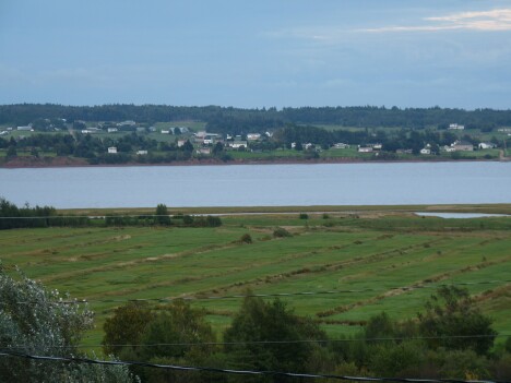
After breakfast, we made the 30 mile trip south to the Hopewell Rock area of the Bay of Fundy. On the way, we drove along the Chocolate River, which seems very aptly named.
As it was low tide and this river connects with the Bay of Fundy, it was basically a chocolate-colored mud flat.
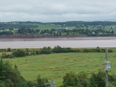
And here is what it looked like coming back home.
We arrived at Hopewell Rocks about 1 pm, a little before the full low tide point at 1:41 pm. The trail down to the Rocks is about 3/4 mile though the forest. Getting there, here is what we saw.

Then we walked down the 125 steps to the ocean floor.
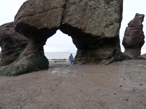
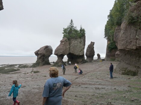
By the time high tide occurs, the water level will be to the top of the narrow sections of the rocks above.
There are a number of warning signs in the area.
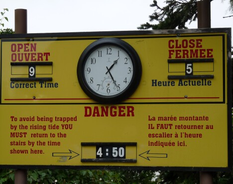
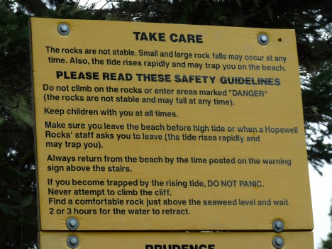
Apparently people are often caught on the ocean floor when the tide comes in. Someone said that someone drowned here a couple of weeks ago.
Because it would be a little over 6 hours until high tide, we drove further down the coast along the Bay of Fundy. On the way we passed a couple of number of scenic views, including a couple of 100-year-old covered bridges, one of which is still in use.
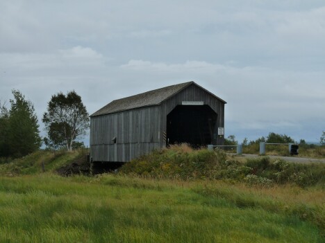
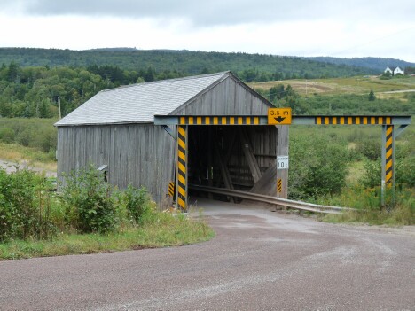
As we neared the Bay of Fundy National Park, we came across these scenic areas. The first is a view of a cliff side shrouded in the fog that had settled in as the day progressed.

Nearby was a boat dock that shows the problem of mooring boats in an area where the water level varies 30-50 feet twice a day.

Finally we headed back up the coast to Hopewell Rocks to see the results of the tide coming in.

Unfortunately we weren’t able to stay for the full high tide because it would occur after dark, and there is no lighting at the Rocks, or on the 3/4 mile walk through the woods to the parking area.
The only downside to our visit was the fact that as the sun went down, the mosquitos came out…with vengeance. You’d think they hadn’t eaten in a year, but they certainly made up for it that night.
We stayed as late as we could. In fact it was downright dark by the time we made it back to the toad.
I’d always heard of the tides at the Bay of Fundy and it was neat to be able to see them for ourselves.
But, maybe the best thing about our Bay of Fundy trip is that Jan finally got to see a Canadian moose!
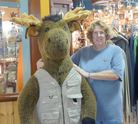
Tomorrow we head back to the good ole USA.
Thought for the Day:
Remember, it’s not officially a “World War” until France surrenders.
cfasdfasdf