Monthly Archives: April 2010
Pacific Coast Highway…
Today was our Pacific Coast Highway road trip.
Two years ago this past March we drove the first part of the PCH where it starts at San Juan Capistrano and Dana Point, up thru Newport Beach, Laguna Beach, Huntington Beach, and ending up in Long Beach. I sense a trend here.
We stayed at an RV Park in Long Beach right on the Pacific Ocean. That’s us on the far left.
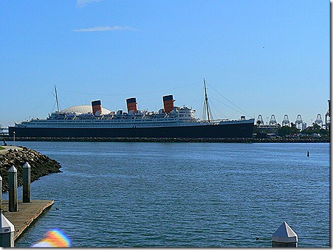
And here was our view out the other way. The Queen Mary.
Anyway, today we drove into LA and got on the PCH near Playa del Rey and headed north.
Coming thru Venice Beach we encountered this strange sight. I’m not exactly sure why a CVS pharmacy has a transgendered clown on its marquee, but it is Venice Beach, after all. But this explains it further.
Coming into Malibu we decided to stop for brunch at Marmalade Cafe right off the PCH. The place was really good, really yuppie, and really expensive. Jan had a short stack of blueberry pancakes with bacon and I had a tortilla scramble. And it was $33!
Leaving the cafe, we headed north again. About 3 miles down the road we came across the Malibu RV Park high on a cliff overlooking the PCH and the Pacific Ocean.
What a view! We may have to think about staying here a few nights when we come back this way next year.
Moving on along the PCH we started encountering some of the really scenic areas.
This shot I think I’ve seen in a lot of movies and TV shows. It’s Point Mugu.
Reaching Santa Barbara, we turned around and headed back, this time taking a different, more scenic route. Rather than go all the way back down to LA and back up, we cut across thru the Los Padres National Forest, to Ojai.
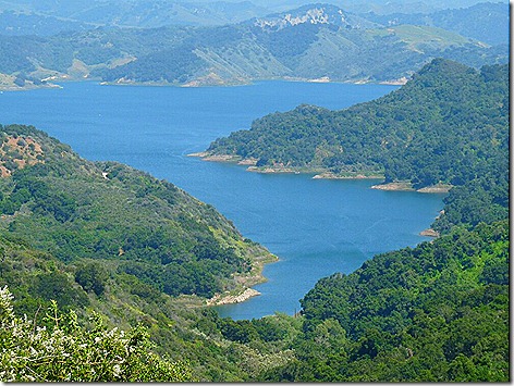
This is Lake Casitas, a 420 sq. mile lake that’s over 1000 ft up in the mountains, and it’s really a great view.
Along the route we passed thru Ojai (pronounced ‘O HIGH”), I had heard of the Ojai Valley before, and it’s easy to see why. It’s just one big garden. Tree farms, nurseries, fruit orchards with lemons, limes, and strawberries, sod farms, you name it.
Leaving Ojai, we passed thru Santa Paula, Fillmore, and on to Santa Clarita on I-5 Then it was a straight shot back to Lancaster and home, a total trip of about 300 miles.
Tomorrow will be a ‘rest up” and “get ready to travel” day, since we plan on leaving here Monday morning,and moving north about 230 miles closer to San Francisco.
More Later.
Esther’s Tacos and Mulholland Dr…
I finally finished redoing the blog entry on our visit to the La Brea Tar Pits so you can check it out here.
————————————————————————————–
Today was a road trip day.
We left the rig about 9 am heading south to Esther’s Taco House in Placentia, CA about 100 miles away.
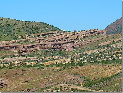
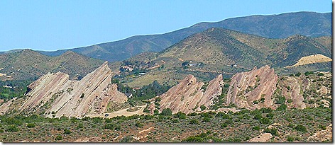
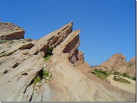
On the way I pulled over to take some shots of the Vasquez Rocks. Although they don’t look real impressive here, when you see them in person they really stand out. You’re driving along thru the high desert mountains, with the hills covered in scraggly scrub brush and small bushes. Click to enlarge the pics.
Then you take a curve on the freeway and suddenly you encounter these massive rocks thrusting up from the surrounding land.
It turns out that this is the route of the San Andreas fault line, and these rocks have been pushed up from deep underneath the earth.
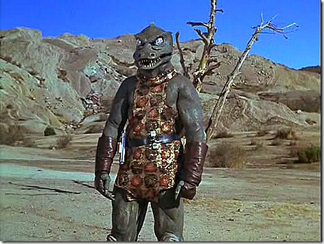
Named after an outlaw, Tiburcio Vásquez, who hid out here in the 1870’s and 80’s, the rocks have been featured in countless commercials, movies, and TV shows, including a famous Star Trek episode called “Arena’, where Capt. Kirk is fighting the reptilian Gorn. The rocks in the background here are here at Vasquez.
This upthrust formation also figures prominently in this show, and numerous others .
We got to Esther’s about 11 and sat down to a another great meal. We wanted to eat here one last time before we leave on Monday. And as before, it was really good. They make the best Chile Rellano I have ever eaten. And their enchiladas are delicious too.
Before we left Esther’s I called Park of the Sierras RV Park to be sure they would have a space for us on Monday. They said yes, so we’re good to go.
Our next destination was Olvera Street in downtown Los Angeles. It’s the oldest remaining part of the city, and some of the buildings date from the 1870’s.
Across the street from Olvera Street, we found Los Angeles’ famous Union Station train station. Built in 1939, it is known as the last of the great train stations built in the US. And, built in the Santa Fe style, it doesn’t really look like a train station. Many movies, commercials, and TV shows have been filmed here.
Coincidently, Union Station figured prominently in last night’s (4/22/2010) episode of ABC’s “Flashforward”.
Next we headed up I-405 and exited at Mulholland Dr.. We wanted to make the famed drive thru the Santa Monica Mountains to get a bird’s eye view of Los Angeles. And we certainly did. Click to enlarge the pics.
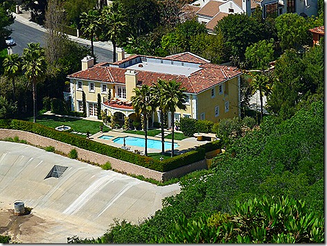
It’s amazing how many homes are built along here, and, considering how many of them seem to be just hanging off the side of the hill, you can see how landsides can damage so many homes.
Seeing how this is California, i was hoping for some nude sunbathing, but no such luck.
Many stars have homes along here, such as Jack Nicholson, Pamela Anderson, Reece Witherspoon and Paris Hilton. Unfortunately, we didn’t see any stars, but we really enjoyed the drive.
We got home about 4 pm and settled in for the night.
And tomorrow we’re going to do it all over again. We’re going to drive back into LA to Playa del Rey on the coast, and then head north along the PCH (Pacific Coast Highway) up to Santa Barbara, before returning home.
Then Sunday, we’ll get ready to travel, before heading out on Monday to the Park of the Sierras RV park north of Fresno..
More Tomorrow…


